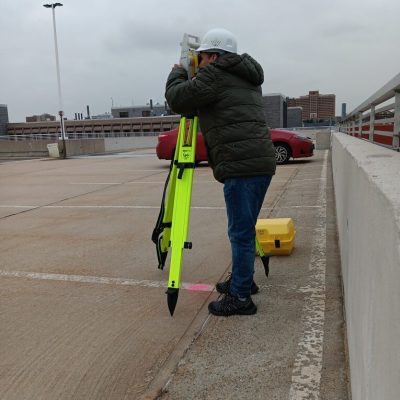
Who We Are
Fractal Synergy specializes in field data collection services, including GNSS, drone mapping, and robotic total station surveys. We do not provide boundary or topographic survey determinations. All data collection services are performed under the direct supervision of licensed professional land surveyors, as required by state regulations. With over 14 years of combined experience, we bring accuracy, efficiency, and cutting-edge technology to support licensed surveyors and engineering firms. Our role is to be your trusted field data collection partner—enhancing your workflow and helping you deliver faster, more reliable results.
Why Fractal Synergy?
Advanced field data collection using GPS/GNSS, robotic total stations, and 3D laser scanners.
Solutions tailored to the specific requirements of your licensed surveying or engineering project.
Fast, reliable, and accurate data delivery—performed under the supervision of licensed professionals.
Our Expertise
Field Data Collection Services
Support for Boundary & Topographic Surveys (under supervision)
Construction Stakeout
Support licensed professionals with site layout & staking
Mapping & Geospatial Services
GIS Mapping, 3D Visualization, and Spatial Analysis.
Ready to Start Your Project?
Let us bring accuracy, speed, and innovation to your field data collection needs.
Contact us today to see how we can support your surveying and geospatial projects—compliantly and effectively.
Fractal Synergy
Contact Information
- 414 Jelliff Ave, Newark, NJ, 07112.
- c.otavalo@fractal-synergy.com / info@fractal-synergy.com
- +1 (862) 306-5472.
